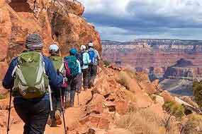
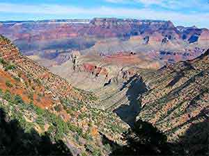
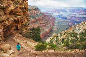
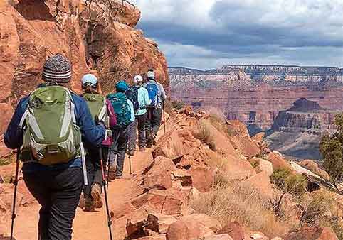
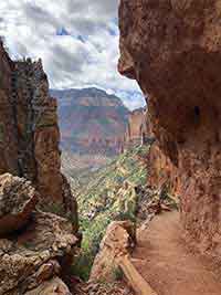
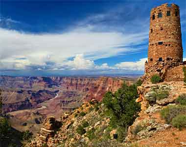
Bright Angel Trail is the best-known hiking route from the Grand Canyon South Rim into the inner canyon. The trail begins just west of Kolb Studio in Grand Canyon Village and descends through a long series of switchbacks to Havasupai Gardens, Plateau Point, the Colorado River and connecting trails near Phantom Ranch.
Seasonal drinking-water stations, resthouses, toilets and occasional shade make Bright Angel more developed than many Grand Canyon trails. They do not make it easy. A hike that begins with a quick downhill walk ends with a steep climb back to the South Rim at nearly 7,000 feet in elevation.
Most visitors should choose a turnaround point well above the Colorado River. The best destination depends on temperature, trail conditions, available daylight, water status and the ability of the slowest person in the group.
Do Not Hike to the River and Back in One Day
The National Park Service does not recommend hiking from the South Rim to the Colorado River and returning in one day. Bright Angel Trail loses approximately 4,460 feet over 7.8 miles before reaching the river, and every foot of that elevation must be regained on the return.
Before entering the canyon, check current trail closures, heat risk, weather and drinking-water status. Water stations can stop working without warning because of pipeline breaks, freezing conditions, maintenance or construction.
Check Current Conditions Before Every Hike
Bright Angel Trail and its inner-canyon connections have been affected by the multi-year Transcanyon Waterline Replacement Project. Construction schedules, temporary delays and water availability can change throughout the year.
Review current trail closures, heat risk and water availability »
| Bright Angel Trail at a Glance | What to Know |
|---|---|
| Trailhead | Grand Canyon Village, just west of Kolb Studio |
| Trail type | Steep out-and-back corridor trail with inner-canyon connections |
| Trailhead elevation | Approximately 6,860 feet |
| Distance to Colorado River | Approximately 7.8 miles one way |
| Elevation loss to river | Approximately 4,460 feet |
| Good first-time turnaround | Mile-and-a-Half Resthouse when conditions are suitable |
| Drinking water | Available at selected locations when operating; never guaranteed |
| Restrooms | At the resthouses, Havasupai Gardens and selected inner-canyon locations |
| Day-hike permit | Not required |
| Overnight permit | Required for backcountry camping below the rim |
| Pets | Not permitted below the rim |
Choose a Bright Angel Trail Turnaround Point
Bright Angel Trail is not a single hike with one required destination. It is a route into the canyon with several logical turnaround points. A shorter hike still provides the experience of walking below the rim without turning the day into an endurance contest.
The distances below are based on National Park Service trail measurements. Hiking times are estimates and vary widely with heat, ice, elevation, fitness and time spent resting.
Short Walk Below the Rim
Suggested distance: Turn around whenever conditions or comfort require
Best for: Limited time, families and visitors testing the trail
You do not need to reach a named landmark to experience Bright Angel Trail. A short descent below the rim reveals the upper switchbacks, changing canyon walls and the dramatic difference between standing at an overlook and entering the canyon.
This is the safest choice for visitors with limited time, uncertain footing, young children or little experience hiking at elevation. Set a turnaround time before beginning and remember that the return is entirely uphill.
Mile-and-a-Half Resthouse
Official distance from rim: 1.6 miles one way
Approximate roundtrip: 3.2 miles
Elevation change: About 1,130 feet
Typical time: 2 to 4 hours
Mile-and-a-Half Resthouse is the most practical named destination for many first-time canyon hikers. It provides a substantial hike below the rim without the much larger commitment required to reach the next resthouse.
The site normally includes a toilet, emergency phone and seasonal drinking water. Water is commonly scheduled from mid-May through mid-October, but outages can occur at any time. Carry what you need rather than planning around the faucet.
This hike can still become dangerous during extreme heat, winter ice or thunderstorms. Reaching the resthouse is optional. Returning safely is not.
Three-Mile Resthouse
Official distance from rim: 3.1 miles one way
Approximate roundtrip: 6.2 miles
Elevation change: About 2,110 feet
Typical time: 4 to 6 hours or longer
Three-Mile Resthouse is a strenuous day-hike destination. Hikers who reach it must regain more than 2,000 feet of elevation, with the steepest upper switchbacks waiting near the end of the return.
The resthouse normally has a toilet, emergency phone and seasonal drinking water. The station may be turned off because of winterization, maintenance or pipeline problems.
Do not treat Three-Mile Resthouse as a small extension of the previous stop. Continuing from the Mile-and-a-Half Resthouse nearly doubles the total distance and significantly increases the effort required to climb out.
Havasupai Gardens
Official distance from rim: 4.5 miles one way
Approximate roundtrip: 9 miles
Elevation change: About 3,060 feet
Typical time: 6 to 9 hours or longer
Havasupai Gardens is a developed rest area and backcountry campground beside Garden Creek. It has shade, picnic tables, toilets, an emergency phone, a ranger station and drinking water when the system is operating.
The location was formerly known as Indian Garden. Older maps and trip reports may still use that name.
Havasupai Gardens is an ambitious day-hike destination. It requires strong fitness, favorable weather, an early start and enough food and water for a climb of more than 3,000 vertical feet.
Reaching Havasupai Gardens is only the halfway point. The return is continuously uphill, and the final miles are the steepest. The National Park Service advises hikers to consult a ranger before attempting this as a day hike.
Plateau Point
Approximate distance from rim: About 6 miles one way
Approximate roundtrip: About 12 miles
Elevation change: More than 3,000 feet
Typical time: 9 to 12 hours or longer
Plateau Point is reached by following the Plateau Point Trail from Havasupai Gardens across the exposed Tonto Platform. The overlook provides a dramatic view approximately 1,300 feet above the Colorado River.
The route adds roughly three exposed roundtrip miles to an already demanding Havasupai Gardens hike. There is little shade beyond the gardens, and hikers still face the full climb back to the South Rim.
Plateau Point Trail has experienced extended construction closures in recent years. It is currently open, but visitors should verify its status before planning the hike.
Colorado River and River Resthouse
Official distance from rim: Approximately 7.8 miles one way
Approximate roundtrip: Approximately 15.6 miles
Elevation change: Approximately 4,460 feet
Best planned as: Part of a permitted overnight itinerary
Bright Angel Trail reaches the Colorado River near River Resthouse. From here, connecting trails lead toward the footbridges, Bright Angel Campground and Phantom Ranch.
The Colorado River is not a reasonable day-hike destination for most South Rim visitors. Reaching the bottom places hikers in the hottest section of the canyon before an uphill return of nearly one vertical mile.
Seeing the river does not mean the difficult portion is over. It means the climb has not started.
Bright Angel Campground and Phantom Ranch
Bright Angel Campground: Approximately 9.5 miles from the South Rim
Phantom Ranch: Approximately 9.9 miles from the South Rim
Reaching either destination requires continuing beyond River Resthouse and crossing to the north side of the Colorado River using an open connecting trail and footbridge.
Bright Angel Campground requires a backcountry permit. Phantom Ranch lodging and meals require separate advance reservations. Neither is available as an improvised overnight option for an exhausted day hiker.
Construction can affect the River Trail, Silver Bridge, Black Bridge and other inner-canyon connections independently of Bright Angel Trail. Overnight hikers should verify the entire route rather than checking only whether the trailhead is open.
Water, Weather and Bright Angel Trail Safety
Drinking Water
Bright Angel Trail has water infrastructure at several locations, but no station should be treated as guaranteed.
Water may be available at:
- Bright Angel Trailhead
- Mile-and-a-Half Resthouse, normally on a seasonal schedule
- Three-Mile Resthouse, normally on a seasonal schedule
- Havasupai Gardens
- Bright Angel Campground and Phantom Ranch
Pipeline breaks, power failures, maintenance, freezing temperatures and construction can interrupt service with little notice. Carry enough water for the planned hike and bring a reliable treatment method on longer or overnight routes.
Never drink untreated water from Garden Creek, seeps or the Colorado River.
Check current drinking-water status »
How Long the Climb Takes
The descent often feels surprisingly easy, which encourages hikers to travel farther than they should. The climb back usually takes substantially longer.
The National Park Service advises hikers to monitor their descent time and allow as much as twice that amount for the return. Many first-time Grand Canyon hikers average approximately one mile per hour while climbing uphill.
Set a turnaround time before beginning. Do not wait until you feel tired, because fatigue commonly appears after the most convenient turnaround point is already behind you.
Summer Heat
Temperatures rise as Bright Angel Trail descends. The inner canyon can be approximately 30°F warmer than the South Rim, turning a comfortable morning at the trailhead into dangerous heat farther below.
Summer heat is commonly most severe from late morning through afternoon. Canyon walls reflect heat, shade becomes limited and the uphill return requires more water, food and time than the descent.
During hot weather:
- Begin very early when experience and conditions allow.
- Avoid climbing during the hottest portion of the day.
- Eat salty foods and substantial calories.
- Rest in shade before exhaustion develops.
- Carry more water than the distance appears to require.
- Choose a shorter turnaround when heat risk is elevated.
Confusion, vomiting, loss of coordination, severe weakness and inability to continue are emergency warning signs. Rescue may take hours and is never guaranteed.
Winter Snow and Ice
Snow and ice frequently remain on the upper switchbacks after roads and sunny rim areas appear clear. Shaded sections can become hard-packed and polished by heavy foot traffic.
Traction devices may be essential from late fall through early spring. Trekking poles improve balance but do not replace proper footwear or traction.
Winter hikers may encounter snow near the rim, mud at middle elevations and much warmer conditions farther inside the canyon. Carry layers for the entire range.
Thunderstorms, Rockfall and Flash Flooding
Summer monsoon storms can produce lightning, heavy rain, rockfall and sudden runoff. Dangerous conditions may develop even when skies were clear at the start of the hike.
Check forecasts for both Grand Canyon Village and the inner canyon. Avoid narrow drainage areas when flooding is possible and stay alert for falling rocks during and after storms.
Mules and Trail Courtesy
Bright Angel Trail is used by mule and stock teams. Hikers must yield to them.
When animals approach:
- Listen for instructions from the wrangler.
- Move to the uphill side of the trail when directed.
- Remain still and quiet.
- Do not stand on the exposed outer edge.
- Wait until the entire group has passed before moving.
Uphill hikers generally have the right of way over downhill hikers, but narrow sections require patience and clear communication.
Food and Energy
Drinking water alone is not enough for a long canyon hike. The sustained uphill return requires salt, carbohydrates and calories.
Carry foods that remain appealing in heat and eat small amounts regularly. Loss of appetite, nausea or an inability to eat may signal heat illness or exhaustion.
Plan Your Bright Angel Trail Hike
Finding the Trailhead
Bright Angel Trailhead is in the Grand Canyon Village Historic District, immediately west of Kolb Studio and near Bright Angel Lodge.
The trailhead is within walking distance of El Tovar, Kachina Lodge, Thunderbird Lodge, Bright Angel Lodge, Maswik Lodge and the Grand Canyon Railway Depot.
Plan your time in Grand Canyon Village »
Parking
Parking immediately beside the trailhead is limited. Do not plan a hike around finding a space next to the rim shortly before departure.
Parking Lot D near the Backcountry Information Center is the standard parking area recommended for many inner-canyon hikers. It is a relatively short walk from Bright Angel Trailhead.
Day visitors may also park in a larger designated lot elsewhere in Grand Canyon Village and use the free village shuttle system according to the current seasonal schedule.
Write down or photograph the lot number before beginning. After a long climb, similar-looking parking areas can become a small navigational gremlin.
Permits and Overnight Camping
No permit is required for an ordinary Bright Angel Trail day hike.
A Grand Canyon backcountry permit is required for camping below the rim, including at Havasupai Gardens Campground and Bright Angel Campground.
A campground permit does not include Phantom Ranch lodging or meals. Day hikers may not use a backcountry campsite as an unplanned overnight destination because they are too tired to return.
Best Time to Hike
Spring
Spring may bring mild temperatures at middle elevations, but snow and ice can remain on the upper trail while the inner canyon becomes warm. Spring break also increases trail traffic.
Summer
Extreme inner-canyon temperatures make long day hikes dangerous. Many visitors should limit themselves to a short, early descent or remain on the Rim Trail.
Fall
Cooling temperatures often improve hiking conditions. Daylight becomes shorter, and seasonal water stations may be winterized later in the season.
Winter
Lower elevations may be mild while the upper switchbacks remain snowy and icy. Traction devices, warm layers and a conservative turnaround are often necessary.
Review Grand Canyon weather by season »
Bright Angel Trail vs. South Kaibab Trail
| Bright Angel Trail | South Kaibab Trail |
|---|---|
| Begins in Grand Canyon Village | Trailhead is not open to private vehicles |
| Approximately 7.8 miles to the river | Approximately 6.3 miles to the river |
| Seasonal water at selected locations | No water along the trail |
| Some shade and developed rest areas | Very exposed with broad ridgeline views |
| Often preferred for the uphill portion of overnight loops | Often preferred for descending on overnight loops |
| Named resthouse turnaround points | Common turnarounds include Ooh Aah Point and Cedar Ridge |
Both trails are steep and strenuous. The South Kaibab-to-Bright Angel loop is a serious inner-canyon itinerary most appropriate for properly prepared and permitted overnight hikers. It does not turn a rim-to-river day hike into a safe shortcut.
Compare Grand Canyon hiking trails »
Difficulty depends on the turnaround point. A short walk below the rim may take less than an hour, while Havasupai Gardens is an all-day hike for many visitors.
The trail is deceptive because it begins downhill. Hikers can descend quickly before realizing that the return requires a sustained climb at high elevation.
Even though Bright Angel is maintained and heavily traveled, it becomes a backcountry trail as soon as you descend below the rim.
Many prepared first-time hikers should make Mile-and-a-Half Resthouse their maximum planned destination. Others should turn around sooner because of heat, ice, limited daylight or physical condition.
Three-Mile Resthouse should be treated as a separate strenuous hike, not an automatic extension.
Turning around early is good trail judgment. A named destination has no magical powers and will not carry you back uphill.
Some children can safely hike a short distance below the rim with close adult supervision. The trail includes steep drop-offs, mule traffic, loose surfaces and rapidly changing weather.
Keep children within reach and choose a conservative turnaround. End the hike immediately if a child becomes tired, frightened, overheated or unwilling to continue.
Plan around what the child can climb uphill at elevation, not how far the child can walk downhill.
Solo hiking is permitted, but it increases the consequences of illness, injury, unexpected weather and poor decisions.
Solo hikers should leave a detailed itinerary with a responsible person, carry emergency supplies and remain within their experience. Do not depend on cell service.
The trail may be busy near the rim, but other hikers are not an emergency plan.
Cell service is unreliable and should not be treated as emergency equipment. Canyon walls block signals, and batteries drain more quickly in temperature extremes.
Download maps before hiking, carry a physical backup and tell someone your planned route and return time.
Emergency phones are available at selected developed locations, including the resthouses and Havasupai Gardens, but reaching one may require substantial travel.
- Sufficient drinking water
- Salty snacks and substantial food
- Supportive hiking footwear
- Sun protection and sunglasses
- Warm and weatherproof layers
- A headlamp, even for a planned daytime return
- Downloaded and printed trail information
- Basic first-aid and blister supplies
- Water treatment for longer backcountry routes
- Traction devices during icy conditions
Trekking poles can improve balance and reduce strain, but they cannot rescue an overly ambitious itinerary.
There is no routine shuttle, elevator or guaranteed mule ride from the inner canyon to the South Rim.
Emergency response may be delayed by weather, darkness, location and available personnel. Helicopter evacuation is not guaranteed and is reserved for appropriate emergencies, not ordinary fatigue or poor planning.
The safest strategy is a conservative destination, an early turnaround and enough energy held in reserve for the climb.
Bright Angel Trail FAQs
Is Bright Angel Trail open?
Bright Angel Trail is currently open from Grand Canyon Village to River Resthouse. Construction, weather, rockfall and waterline problems can change access. Check the National Park Service’s current hiking messages before entering the canyon.
Do you need a permit to hike Bright Angel Trail?
No permit is required for a normal day hike. A backcountry permit is required to camp below the rim.
How long is Bright Angel Trail?
Bright Angel Trail is approximately 7.8 miles one way from the South Rim to the Colorado River. Bright Angel Campground is approximately 9.5 miles from the rim, and Phantom Ranch is approximately 9.9 miles away using connecting trails.
How long does a Bright Angel Trail hike take?
A hike to Mile-and-a-Half Resthouse commonly takes two to four hours. Three-Mile Resthouse may require four to six hours or longer, while Havasupai Gardens can take six to nine hours. The climb out may take twice as long as the descent.
Is there drinking water on Bright Angel Trail?
Water is normally available at selected locations, including seasonal stations at Mile-and-a-Half and Three-Mile Resthouses and a station at Havasupai Gardens. Breaks, freezing conditions, construction and maintenance can interrupt service without warning.
Can you hike to the Colorado River and back in one day?
The National Park Service does not recommend hiking from the South Rim to the Colorado River and back in one day. The route combines long mileage, extreme temperature changes and approximately 4,460 feet of climbing on the return.
Are dogs allowed on Bright Angel Trail?
No. Pets are not permitted on inner-canyon trails. Leashed pets are allowed on designated trails above the rim, including portions of the South Rim Trail.
Can you camp at Havasupai Gardens?
Yes, but a Grand Canyon backcountry permit is required. Day hikers may use the rest area but cannot stay overnight without a valid permit.
Is Plateau Point open?
Plateau Point Trail is currently open following extended construction closures. Conditions and project schedules can change, so verify current access before planning the hike.
Related Grand Canyon Hiking Guides
- Grand Canyon Hiking Guide
- Grand Canyon Village Visitor Guide
- Phantom Ranch Lodging and Planning Guide
- Grand Canyon South Rim Visitor Guide