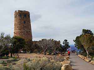
Best Grand Canyon Hiking Trails
Hiking in Grand Canyon National Park is one of the best ways to understand the canyon’s scale, but choosing the right trail is critical. A relatively short distance below the rim can involve a steep descent, intense sun, changing weather and a much harder return climb.
Grand Canyon hikes range from mostly level walks along the South Rim to demanding backcountry routes that descend thousands of feet toward the Colorado River. The best trail depends on your experience, available time, season, physical condition and whether you want to remain on the rim or hike into the canyon.
First-time visitors should usually begin with the Rim Trail, Shoshone Point, Ooh Aah Point or a carefully planned portion of Bright Angel Trail. Grandview, Dripping Springs, New Hance and Rim-to-Rim require substantially more preparation and should not be treated as casual sightseeing walks.
Check current conditions before every hike.
Trail access, drinking-water availability, shuttle routes, construction and weather conditions can change without notice. Carry enough water for the entire hike and bring a way to treat additional water when traveling below the rim.
| Trail | Typical Hike | Difficulty | Best For |
|---|---|---|---|
| Rim Trail | Choose your own distance | Easy to moderate | Families, first-time visitors and flexible walks |
| Shoshone Point | Approximately 2 miles round trip | Easy to moderate | Solitude and a quieter rim viewpoint |
| South Kaibab Trail | 1.8 miles round trip to Ooh Aah Point | Moderate to strenuous | Wide-open views and shorter below-rim hikes |
| Bright Angel Trail | 3 miles round trip to the first resthouse | Strenuous | Maintained trail and several turnaround options |
| Grandview Trail | 6 miles round trip to Horseshoe Mesa | Very strenuous | Experienced hikers, geology and historic mining sites |
| Dripping Springs | Approximately 7 miles round trip | Very strenuous | Experienced desert hikers |
| North Kaibab Trail | Turnaround point determines distance | Strenuous to extreme | North Rim hikers and prepared backpackers |
| New Hance Trail | Up to 13 miles round trip to the river | Extreme | Experienced backcountry hikers |
| Rim-to-Rim | Approximately 21 to 24 miles one way | Extreme | Highly prepared endurance hikers |
Best Grand Canyon Day Hikes
Rim Trail
The Rim Trail is the most flexible hiking option at the South Rim. It extends approximately 13 miles from the South Kaibab Trailhead to Hermits Rest, but visitors can walk almost any shorter section and use park shuttle buses to connect different points.
Much of the trail is paved, although some sections are unpaved and portions travel close to exposed canyon edges. Elevation change is modest compared with trails descending into the canyon.
Good turnaround options:
- Mather Point to Yavapai Point
- Grand Canyon Visitor Center to Grand Canyon Village
- Trailview Overlook to Grand Canyon Village
- One or more overlooks along Hermit Road
Distance:
Up to approximately 13 miles one way, with many shorter options.
Water:
Available in developed areas, but not continuously along the trail. Carry water between services.
Best for:
Families, first-time visitors, sunrise and sunset walks, flexible itineraries and hikers who do not want a major elevation change.
Accessibility:
Several paved sections are accessible, but the entire Rim Trail is not uniformly paved or accessible. Check individual sections before setting out.
See the Complete Rim Trail Guide »
Shoshone Point
Shoshone Point is reached by following an unpaved road through the forest to a quiet picnic area and exposed viewpoint. The walk is relatively level and receives less foot traffic than many developed South Rim overlooks.
The approach is easy by Grand Canyon standards, but the final path to the point is rough and uneven. The viewpoint has steep drop-offs and no guardrails.
Distance:
Approximately 2 miles round trip from the public parking area, plus a short walk to the exposed point.
Elevation change:
Minimal.
Water:
None. Bring all drinking water.
Camping:
Not permitted as part of a normal day hike.
Best for:
A quieter rim walk, forest scenery, picnics and visitors seeking solitude away from the busiest overlooks.
Keep in mind:
Shoshone Point may occasionally be reserved for permitted events, and the final viewpoint is not suitable for unattended children or anyone uncomfortable near unprotected edges.
See the Shoshone Point Hiking Guide »
South Kaibab Trail
The South Kaibab Trail provides some of the most expansive views available on a short hike below the South Rim. It follows an exposed ridgeline with very little shade and no drinking water anywhere along the trail.
The trailhead is closed to private vehicles. Most hikers reach it using the park’s Kaibab/Rim Route shuttle or authorized taxi service.
Ooh Aah Point:
1.8 miles round trip with approximately 790 feet of elevation change. Allow roughly one to two hours, depending on conditions and hiking ability.
Cedar Ridge:
3 miles round trip with approximately 1,120 feet of elevation change. Allow roughly two to four hours.
Skeleton Point:
6 miles round trip with approximately 2,040 feet of elevation change. This is a demanding day hike, and hikers should consult a ranger before attempting it.
Water:
None. Carry the full amount needed for the hike.
Camping:
No camping is permitted along the upper South Kaibab Trail. Overnight backcountry hikers must stay in an authorized campground or use area listed on their permit.
Best for:
Open views, sunrise hikes and experienced visitors seeking a relatively short but steep Inner Canyon experience.
Summer warning:
The South Kaibab Trail has almost no shade and no water. Avoid hiking it during the hottest part of a summer day, and do not descend farther than you can safely climb back out.
See the Complete South Kaibab Trail Guide »
Bright Angel Trail
Bright Angel Trail begins in Grand Canyon Village just west of Bright Angel Lodge. It is one of the park’s best-maintained Inner Canyon trails and offers several established turnaround points.
The wide, graded trail can make the descent feel deceptively manageable. The return is much harder, and hikers should allow substantially more time for the climb back to the rim.
Mile-and-a-Half Resthouse:
Approximately 3 miles round trip with about 1,120 feet of elevation change. Most visitors need two to four hours.
Three-Mile Resthouse:
Approximately 6 miles round trip with about 2,100 feet of elevation change. This is a strenuous hike requiring considerably more time and preparation.
Havasupai Gardens:
Approximately 9 miles round trip. This is a very strenuous all-day hike and is not an appropriate summer objective for most visitors.
Water:
Water may be available seasonally at resthouses and Havasupai Gardens, but pipeline breaks and maintenance can interrupt service. Never depend on a trail faucet without checking the current water status.
Camping:
A backcountry permit is required to camp at Havasupai Gardens Campground or elsewhere below the rim.
Best for:
Prepared hikers seeking a maintained trail with multiple turnaround choices and periodic seasonal water sources.
Bright Angel is not a beginner trail.
It is easier to follow than many backcountry routes, but even the first resthouse requires a steep 3-mile round trip. Choose a conservative turnaround and begin climbing before you feel tired.
See the Complete Bright Angel Trail Guide »
Grandview Trail to Horseshoe Mesa
Grandview Trail descends from Grandview Point along a historic mining route to Horseshoe Mesa. The trail is steep, rocky, narrow and exposed, with sections of old cobblestone that can be especially difficult when wet, icy or covered by loose gravel.
This trail is substantially more rugged than Bright Angel or South Kaibab. Route conditions deteriorate below the rim, and hikers should be comfortable with unstable footing and exposed sections.
Distance:
Approximately 6 miles round trip to Horseshoe Mesa.
Elevation change:
Approximately 2,500 feet.
Water:
No reliable water between the trailhead and Horseshoe Mesa. Carry all water needed for a day hike.
Camping:
A backcountry permit is required for overnight camping. Camping is limited to authorized areas specified on the permit.
Best for:
Experienced hikers interested in geology, historic mining remains, challenging terrain and fewer crowds.
Winter caution:
The upper Grandview Trail is north-facing and can retain dangerous snow and ice. Traction devices and winter hiking experience may be necessary.
See the Complete Grandview Trail Guide »
Dripping Springs Trail
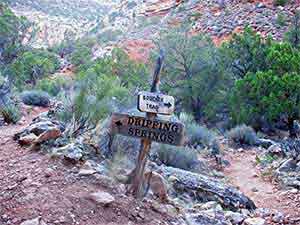
Dripping Springs is reached from Hermit Trailhead near Hermits Rest. Hikers descend the rugged Hermit Trail before following the Dripping Springs spur beneath tall canyon walls.
The route is less maintained and more difficult than Bright Angel Trail. Loose rock, exposed ledges and a steep return climb make it best suited to experienced desert hikers.
Distance:
Approximately 7 miles round trip.
Trailhead:
About 500 feet west of Hermits Rest. From March through November, most visitors reach Hermits Rest using the park shuttle because Hermit Road is closed to ordinary private vehicles.
Water:
Spring water must be treated before drinking. Springs can be affected by seasonal and environmental conditions, so carry sufficient water rather than depending on the source.
Camping:
Dripping Springs is not a designated campground. Overnight travel requires a backcountry permit and an itinerary using an authorized campsite or use area.
Best for:
Experienced hikers looking for a quieter and more rugged alternative to the corridor trails.
See the Complete Dripping Springs Trail Guide »
Advanced Grand Canyon Hikes
North Kaibab Trail
North Kaibab Trail is the only maintained trail that descends from the North Rim to the Colorado River. It begins approximately 1,000 feet higher than the South Rim trailheads and passes through forest, steep rock layers and Bright Angel Canyon.
The complete trail to the river is approximately 14.2 miles one way with about 5,850 feet of elevation change. Day hikers should choose a much shorter turnaround.
Coconino Overlook:
Approximately 1.5 miles round trip. This is the most reasonable below-rim objective for many North Rim day hikers.
Supai Tunnel:
Approximately 4 miles round trip with a substantial climb back to the rim.
Roaring Springs area:
A very strenuous all-day objective that should only be attempted when current trail access, conditions and water availability have been confirmed.
Water:
Seasonal and highly vulnerable to pipeline interruption. Check the current National Park Service water report immediately before hiking.
Camping:
A backcountry permit is required for Cottonwood Campground, Bright Angel Campground and other overnight Inner Canyon itineraries.
Best for:
Prepared North Rim visitors, experienced backpackers and hikers training for a longer canyon crossing.
2026 North Kaibab Trail notice:
The trail reopened to foot traffic for the 2026 season following the Dragon Bravo Fire, but rehabilitation work, post-fire hazards and temporary closures or delays remain possible. A section is scheduled to close beginning October 15, 2026, for Transcanyon Waterline construction. Verify current access before planning any North Kaibab or Rim-to-Rim hike.
See the Complete North Kaibab Trail Guide »
Rim-to-Rim Hike
A Rim-to-Rim hike crosses Grand Canyon between the North and South Rims using North Kaibab Trail and either Bright Angel or South Kaibab Trail. It is one of the park’s most demanding established hiking itineraries.
Distance:
- Approximately 21 miles using South Kaibab and North Kaibab
- Approximately 24 miles using Bright Angel and North Kaibab
Elevation:
The route involves thousands of feet of descent followed by a climb of approximately one vertical mile to the opposite rim. The North Rim trailhead is about 1,000 feet higher than the South Rim.
Direction:
Hiking north-to-south provides a lower final climb but does not make the crossing easy. Weather, transportation, trail closures and lodging can be more important than direction.
Camping:
A backcountry permit is required for overnight trips. Common corridor campgrounds include Cottonwood, Bright Angel and Havasupai Gardens, depending on the approved itinerary.
Water:
Seasonal water may be available at several corridor locations, but breaks in the Transcanyon Waterline can shut off taps without much notice. Every hiker should carry treatment capability.
Best for:
Highly conditioned hikers with Grand Canyon experience, a conservative itinerary and reliable transportation between the rims.
Do not attempt Rim-to-Rim as an unplanned day hike.
A same-day crossing combines high elevation, desert heat, a long distance and a major final ascent. Overnight permits, lodging and shuttle transportation often require planning many months ahead.
See the Complete Rim-to-Rim Hiking Guide »
New Hance Trail
New Hance is one of the South Rim’s most rugged established routes. It descends through Red Canyon to Hance Rapids and receives far less maintenance than Bright Angel, South Kaibab or North Kaibab.
The route is steep, loose and difficult to follow in places. It includes scrambling, unstable footing and limited opportunities to turn a mistake into an easy exit.
Distance:
Approximately 6.5 miles one way from the trailhead to Hance Rapids.
Elevation change:
Approximately 4,400 feet between the South Rim and Colorado River.
Water:
The Colorado River is the only reliable water source on the complete descent and must be treated. Seasonal pools or runoff should never be assumed.
Camping:
A backcountry permit is required for all overnight itineraries.
Best for:
Experienced Grand Canyon backpackers with route-finding skills, backcountry equipment and the ability to manage loose, exposed terrain.
New Hance is not recommended as a casual river-and-back day hike.
A round trip to the Colorado River is approximately 13 miles with about 8,800 feet of total elevation change. Most hikers should approach it as part of a permitted overnight itinerary.
See the Complete New Hance Trail Guide »
Plan a Safe Grand Canyon Hike
Choose a Trail by Ability, Not Distance
A 3-mile Grand Canyon hike can be harder than a much longer walk elsewhere. Elevation change, heat, ice, sun exposure, trail condition and the return climb matter more than mileage alone.
| Experience | Better Starting Options | Avoid Until Prepared |
|---|---|---|
| First visit or limited hiking experience | Rim Trail and selected developed overlooks | Long Inner Canyon hikes |
| Active family | Rim Trail, Shoshone Point or a conservative Ooh Aah Point hike | Havasupai Gardens, Skeleton Point or Rim-to-Rim |
| Fit day hiker | Ooh Aah Point, Cedar Ridge or Mile-and-a-Half Resthouse | River-and-back hikes during one day |
| Experienced desert hiker | Grandview to Horseshoe Mesa or Dripping Springs in suitable weather | Unfamiliar remote routes without maps and preparation |
| Experienced Grand Canyon backpacker | Permitted corridor or remote backcountry itinerary | Trips beyond current conditions or route-finding ability |
Summer Hiking
Inner Canyon temperatures can exceed 110°F in summer, even when conditions at the rim feel comfortable. The National Park Service advises avoiding strenuous Inner Canyon hiking during the hottest part of the day.
During hot weather:
- Begin before sunrise
- Choose a conservative turnaround
- Avoid strenuous hiking between approximately 10 a.m. and 4 p.m.
- Carry water and salty food
- Wet clothing when appropriate
- Rest in shade rather than pushing through symptoms
- Turn around before half of your water is gone
Heat illness can affect fit and experienced hikers. Confusion, vomiting, loss of coordination and an inability to continue are emergency warning signs.
Winter Hiking
Snow and ice can cover upper trail sections while lower elevations remain dry. Shaded trails such as Grandview and Bright Angel may retain ice long after a storm.
Winter hikers may need:
- Over-the-shoe traction devices
- Trekking poles
- Warm layers
- Headlamp
- Extra food and water
- Experience recognizing unsafe ice conditions
Do not assume a trail is safe because the rim overlooks are clear.
Water Is Never Guaranteed
Pipeline breaks regularly affect Inner Canyon water taps. Seasonal sources may be turned off, frozen, contaminated or unavailable because of maintenance.
Before hiking:
- Check the current National Park Service water-status report
- Carry enough water to reach the next confirmed source
- Bring a filter, purifier or chemical treatment method
- Treat all natural water
- Never rely on a spring described in an old article or map
Backcountry Permits
A permit is not required for ordinary day hiking, even when a hike begins before sunrise or ends after dark.
A backcountry permit is generally required when spending a night below the rim, camping outside developed rim campgrounds or following another itinerary covered by backcountry regulations.
Demand is high for corridor campgrounds and popular seasons. Apply as early as the current permit system allows and do not begin an overnight trip without an approved itinerary.
Trailhead Transportation
Access varies by trail:
- Bright Angel Trail: Walkable from Grand Canyon Village and nearby lodging.
- South Kaibab Trail: Closed to private vehicles; use the park shuttle or authorized taxi.
- Hermit and Dripping Springs: Usually reached by the Hermit Road shuttle from March through November.
- Grandview and New Hance: Reached from Desert View Drive, with limited trailhead parking.
- North Kaibab: Seasonal road access from the North Rim, subject to current restrictions.
What to Bring
- More water than you expect to drink
- Water-treatment method for below-rim hikes
- Salty snacks and substantial food
- Topographic trail map
- Sun hat, sunscreen and sunglasses
- Weather-appropriate layers
- Headlamp with spare power
- First-aid supplies
- Well-fitting footwear
- Traction devices in icy conditions
- Emergency contact and itinerary left with another person
Hiking Advice
Choose your turnaround before beginning the descent. Do not let a destination name persuade you to continue after conditions, time or water indicate you should turn around.
Start smaller than you think necessary.
Visitors unfamiliar with Grand Canyon terrain should test themselves on the Rim Trail or a short below-rim hike before committing to a longer route.
Current information outranks this guide.
Check official trail closures, water availability, shuttle schedules and weather on the morning of your hike.
Grand Canyon Hiking FAQ
What is the easiest hike at the Grand Canyon?
A short section of the Rim Trail is the easiest hiking choice for most visitors. It offers canyon views without requiring a steep descent and climb.
What is the best short hike below the rim?
Ooh Aah Point on South Kaibab Trail and Mile-and-a-Half Resthouse on Bright Angel Trail are popular options. Both are strenuous compared with a rim walk.
Is Bright Angel Trail suitable for beginners?
Bright Angel is well maintained and easy to follow, but it is not easy. Beginners should choose a conservative turnaround and remember that climbing out is much harder than descending.
Can you hike to the bottom and back in one day?
The National Park Service strongly discourages rim-to-river-to-rim day hikes. They involve major distance, extreme elevation change and potentially dangerous heat.
Do I need a permit for a day hike?
No backcountry permit is generally required for a normal day hike. A permit is required for most overnight trips below the rim.
Do I need a permit for Rim-to-Rim?
A permit is required when camping overnight below the rim. A same-day crossing does not normally require a backcountry permit, but it remains an extreme undertaking requiring transportation and careful planning.
Can I camp at Phantom Ranch?
Phantom Ranch lodging is reserved separately and is not a trail campground. Bright Angel Campground requires a backcountry permit.
What happened to Indian Garden?
Indian Garden was officially renamed Havasupai Gardens. Older maps, signs and articles may still use the former name.
Is there water on Bright Angel Trail?
Seasonal water may be available at several locations, but service can be interrupted. Check the current water report and carry enough water for unexpected outages.
Is there water on South Kaibab Trail?
No. There is no drinking water along South Kaibab Trail. Hikers must carry all the water they need.
How long does it take to climb out of the Grand Canyon?
The climb often takes approximately twice as long as the descent, although weather, fitness, distance and trail conditions can change that substantially.
What is the best Grand Canyon hike for families?
The Rim Trail is the safest and most flexible choice for most families. Active families with older children may consider a carefully planned hike to Ooh Aah Point.
Can children hike Bright Angel Trail?
Some children can manage a short portion, but adults must consider heat, elevation change, water and the child’s ability to complete the climb without being carried.
Can you hike at the Grand Canyon in summer?
Yes, but rim walks are generally safer than long Inner Canyon hikes. Start early and avoid strenuous hiking during the hottest part of the day.
Can you hike at the Grand Canyon in winter?
Yes. Snow and ice often cover upper trail sections, so traction devices and winter hiking experience may be needed.
Is the North Kaibab Trail open?
Access changes seasonally and can be affected by post-fire work, weather and construction. Check the current National Park Service North Rim status before traveling.
Can I drive to the South Kaibab Trailhead?
No. Private vehicles are not permitted at the trailhead. Use the park shuttle or an authorized taxi.
Are dogs allowed on Grand Canyon trails?
Leashed pets are allowed on designated rim trails but are not permitted on Inner Canyon trails. Service animals are governed by separate rules.
What is the hardest trail in this guide?
New Hance and Rim-to-Rim present the greatest overall demands. Grandview and Dripping Springs are also substantially more rugged than the maintained corridor trails.
Should I hire a hiking guide?
A qualified authorized guide can help with route selection, transportation, interpretation and safety. A guide does not eliminate heat, elevation, physical demands or the need for personal preparation.
Explore Individual Grand Canyon Trails
- Bright Angel Trail
- South Kaibab Trail
- Rim Trail
- Grandview Trail
- Dripping Springs Trail
- Shoshone Point
- North Kaibab Trail
- Rim-to-Rim Hike
- New Hance Trail
Compare More Grand Canyon Experiences
- All Grand Canyon Tours
- Guided Grand Canyon Hiking Tours
- Grand Canyon Bus, Van and Vehicle Tours
- Grand Canyon River Rafting Trips
- Grand Canyon Railway Trips
- Lodges Inside Grand Canyon National Park
GRAND CANYON GUIDED HIKING TRIPS
Sedona Red Rock Tours
Multi-Day Tours | Family-Friendly | Professionally Guided | Hotel Pickup | Multi-Attraction Tours | Private Tours Available | Custom Options Available | ADA Accessible
Colorado River & Trail Expeditions
Meals Included | Professionally Guided | Shuttle Services Provided | Multi-Day Tours | Leaves from Las Vegas | Additional Tour Options Available | Motorized-Oar-Paddle-Options | Family Business
Wildland Trekking
Family-Friendly | Professionally Guided | Shuttle Services Provided | Gear Rental Available or Provided | Meals Included | Multi-Day Tours
Private Grand Canyon Hiking Tours
Professionally Guided | Lunch Included | Shuttle Services Provided | Hotel Pickup
Local Business Spotlight