Desert View Drive is a 23-mile scenic road connecting Grand Canyon Village with Desert View and the park’s East Entrance. Unlike Hermit Road, the route is open to private vehicles throughout the year unless snow, ice or another temporary closure makes travel unsafe.
The drive follows Arizona State Route 64 east from the South Entrance Road junction, passing six developed canyon viewpoints, four picnic areas, several unmarked pullouts and the Tusayan Pueblo Archaeology Site. It ends at Desert View, where visitors can explore the historic Watchtower, see a broad bend of the Colorado River and access food, fuel, restrooms and seasonal camping.
Driving straight from Grand Canyon Village to Desert View takes approximately one hour. A useful sightseeing trip usually requires three to five hours, depending on how many overlooks and historic sites you visit.
2026 Lipan Point Closure
Lipan Point and Lipan Point Road are closed to all visitor use from June 22 through December 23, 2026, for overlook rehabilitation and maintenance.
Desert View Drive remains open. Use Navajo Point, Moran Point or Desert View Point as alternatives and check current National Park Service alerts before traveling.
Best Desert View Drive Strategy
Drive the route in one direction rather than treating it as a separate out-and-back excursion. Enter through the South Entrance and leave through the East Entrance toward Cameron, Page or Monument Valley, or reverse the route when arriving from the east.
Visitors returning to Grand Canyon Village should allow approximately two hours of driving time plus time at each stop.
| Desert View Drive at a Glance | What to Know |
|---|---|
| Location | Grand Canyon South Rim between Grand Canyon Village and Desert View |
| Road number | Arizona State Route 64 |
| Length | Approximately 23 miles one way |
| Driving time without stops | Approximately 1 hour |
| Recommended sightseeing time | 3 to 5 hours |
| Developed canyon viewpoints | Six, although Lipan Point is temporarily closed in 2026 |
| Private vehicles | Permitted year-round when the road is open |
| Shuttle service | No regular park shuttle operates the full scenic drive |
| East Entrance | Open 24 hours daily unless temporarily closed |
| Food and fuel | Available at Desert View according to current operating hours |
| Overnight lodging | Not available at Desert View |
Desert View Drive Viewpoints and Stops
Desert View Drive begins near Grand Canyon Village at the junction of South Entrance Road and State Route 64. The stops below are listed from west to east, ending at Desert View near the East Entrance.
Parking is available at each developed viewpoint, but smaller lots can fill during summer, holidays and busy weekends. Pull completely off the roadway and use designated parking rather than stopping beside traffic.
Pipe Creek Vista
Mile marker: 242.5
Best for: A quick first view and Rim Trail access
Pipe Creek Vista is the first developed canyon viewpoint east of the South Entrance Road junction. It overlooks Pipe Creek Canyon and provides access to the paved Rim Trail.
From the viewpoint, visitors can walk approximately 1.3 miles west to Mather Point or approximately 0.8 mile east to the South Kaibab Trailhead. The distances are based on current National Park Service route information.
Pipe Creek Vista can also be reached using the free Kaibab Rim, or Orange Route, shuttle from the Grand Canyon Visitor Center. Because it is close to the village and accessible by both vehicle and shuttle, the parking area can become congested.
Visitors already planning to explore Mather Point and the eastern Rim Trail may not need to make this a separate driving stop.
Duck on a Rock
Mile marker: 246
Elevation: Approximately 7,096 feet
Best for: A brief roadside stop and unusual rock formation
Duck on a Rock is a roadside viewpoint named for a pale rock formation that early visitors believed resembled a duck. Whether it still looks like a duck depends on the angle, lighting and generosity of your imagination.
The stop offers a canyon view but is less developed than Grandview, Moran or Desert View. It works best as a quick pause rather than one of the route’s essential destinations.
Grandview Point
Mile marker: 251
Elevation: Approximately 7,399 feet
Best for: Panoramic views, forest scenery and historic trail access
Grandview Point is one of the highest and most dramatic overlooks along Desert View Drive. Its elevation provides broad views from east to west, including several bends of the Colorado River in the eastern canyon.
The overlook occupies a forested promontory and has a different character from the more open desert scenery near the East Entrance. It is a strong choice for morning photography, changing weather and visitors who want a wide panorama without driving all the way to Desert View.
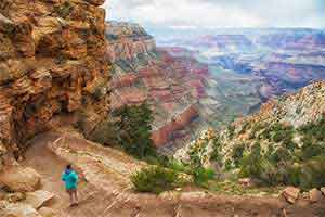
The historic Grandview Trail begins here. The trail was developed during the mining era and descends steeply into the canyon.
Grandview Trail is extremely steep. It is not a casual extension of the viewpoint. Summer sun, loose terrain, winter ice and limited water make it more demanding than the developed overlook suggests.
Moran Point
Mile marker: 258
Elevation: Approximately 7,160 feet
Best for: Geology, color and a less hurried viewpoint
Moran Point is named for artist Thomas Moran, whose paintings helped introduce Grand Canyon landscapes to a national audience during the nineteenth century.
The overlook provides a particularly useful view of three major Grand Canyon rock groups:
- The layered Paleozoic sedimentary rocks forming much of the upper canyon
- The tilted and isolated formations of the Grand Canyon Supergroup
- The dark metamorphic and igneous basement rocks near the river
Differences in rock type, angle and color are easier to recognize here than at many western South Rim viewpoints. Moran Point is often less congested than Mather Point or the most famous sunset stops along Hermit Road.
Tusayan Pueblo Archaeology Site
Location: Approximately 3 miles west of Desert View
2026 season: April 2 through October 31
2026 hours: Thursday through Monday, 8 a.m. to 4 p.m.
Tusayan Pueblo preserves the remains of a small Ancestral Puebloan community occupied roughly 800 years ago. A short self-guided trail circles the pueblo and its visible room foundations, including the outline of a kiva.
The site adds important human context to a drive otherwise dominated by scenery. Grand Canyon is not an untouched landscape discovered by modern travelers. Indigenous communities have lived in, traveled through and maintained relationships with this region for thousands of years.
A Native American Artisan Market may operate at the site during the visitor season, with artwork and crafts offered by participating Indigenous artists.
Hours and seasonal dates can change, so verify current operations before planning the stop as the centerpiece of your drive.
Lipan Point
Mile marker: 263.5
Elevation: Approximately 7,360 feet
2026 status: Closed through December 23, 2026
Lipan Point normally provides one of the clearest extended views of the Colorado River from the South Rim. Visible features can include Hance Rapid, Unkar Delta and sections of the Grand Canyon Supergroup.
The overlook and its access road are closed to all visitor use during the 2026 rehabilitation project. Do not enter the closure area or park along Highway 64 near the Lipan Point Road intersection.
The Tanner Trail remains open during the project. Hikers must use the designated parking area at No Name Point, approximately 1,000 feet west of Lipan Point Road, and walk to the trailhead. Tanner Trail is a difficult backcountry route and should not be attempted as a substitute sightseeing stop.
For a similar eastern-canyon perspective during the closure, continue to Navajo Point or Desert View Point.
Navajo Point
Mile marker: 264
Elevation: Approximately 7,461 feet
Best for: Watchtower views, Colorado River scenery and high-elevation panoramas
Navajo Point is the highest developed overlook on the South Rim. It provides a broad view west across the canyon, north along the Colorado River and east toward Desert View Watchtower.
The overlook is one of the best places to photograph the Watchtower in its landscape rather than from immediately beside the building. It is also a useful alternative while Lipan Point is closed.
A memorial at Navajo Point commemorates the 1956 midair collision between TWA and United Airlines aircraft over Grand Canyon. The disaster became an important event in the history of American aviation safety and air traffic control.
Navajo Point is only a short drive from Desert View, but the perspective is different enough to justify stopping at both.
Desert View Point
Mile marker: 264.5
Elevation: Approximately 7,438 feet
Best for: Colorado River views, Watchtower history and visitor services
Desert View Point marks the eastern end of the scenic drive. A roughly quarter-mile walk leads from the parking area past visitor-service buildings to the canyon rim and Desert View Watchtower.
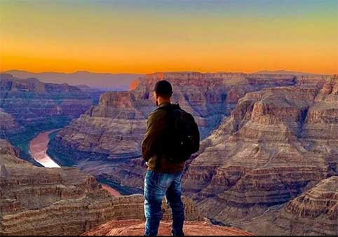
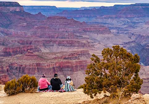
The viewpoint looks north and west across one of the widest sections of Grand Canyon. The Colorado River is visible as it curves through the eastern canyon, while the Painted Desert and Navajo Nation extend beyond the park to the east.
Desert View is more than a single overlook. It includes the Watchtower, trading post, market, seasonal cultural demonstrations, restrooms, fuel and a seasonal campground.
Which Desert View Drive Stops Should You Prioritize?
| Visitor Goal | Recommended Stop |
|---|---|
| Best broad western panorama | Grandview Point |
| Best geology interpretation | Moran Point |
| Best cultural-history stop | Tusayan Pueblo |
| Best Watchtower photograph | Navajo Point |
| Best Colorado River view during the 2026 Lipan closure | Desert View Point or Navajo Point |
| Best visitor services | Desert View |
| Best three-stop itinerary | Grandview Point, Moran Point and Desert View |
Desert View Watchtower and Visitor Services
Desert View Watchtower
Desert View Watchtower is a 70-foot stone structure designed by architect Mary Colter and completed in 1932 for the Fred Harvey Company. Colter drew inspiration from ancestral Puebloan towers and other architecture of the Colorado Plateau.
The Watchtower was designed as an interpretive and scenic structure rather than as a reconstruction of one specific archaeological building. Its stonework, massing and interior details were intended to create a respectful connection with regional Indigenous architecture and culture.
The ground-floor View Room contains a Grand Canyon Conservancy park store and is normally open daily. Cultural demonstrations by participating Indigenous artists are offered seasonally.
Can You Climb the Watchtower?
Upper-floor access is available when staffing permits. Current 2026 operating information lists upper-level access from 8 a.m. to 6 p.m., with the final tower entry at 6 p.m.
Access is free but controlled through an onsite ticket system:
- Capacity is limited to 25 visitors at one time.
- Visits are limited to approximately 20 minutes.
- Tickets are distributed onsite.
- The final tickets are normally distributed at 5:40 p.m.
- Children must be accompanied by an adult.
Staffing, weather or preservation needs can close the upper levels without closing the ground-floor View Room. Do not promise children a tower climb until you have obtained a ticket.
Watchtower Accessibility
The ground-level View Room can be visited without climbing the tower stairs. The upper floors are reached using a narrow interior staircase and are not wheelchair accessible.
Visitors who cannot climb the tower can still see the building, explore the rim area and enjoy expansive canyon and Colorado River views from Desert View Point.
Food, Water and Shopping
Current Desert View services include:
- Desert View Market
- A deli inside the market
- Trading Post with Native American handicrafts
- Coffee and ice cream
- Grand Canyon Conservancy park store in the Watchtower View Room
- Drinking-water access
- Public restrooms
Operating hours vary by facility and season. Bring enough food and water for everyone in the vehicle, particularly when traveling early, late or during winter.
Gas Station
A pay-at-the-pump gas station operates at Desert View and accepts credit or debit cards at the pump. Current NPS information lists pump access as available 24 hours.
Fuel availability is useful for travelers continuing toward Cameron, Page, Monument Valley or other destinations across the Navajo Nation. It is still sensible to begin the drive with adequate fuel rather than treating the station as a rescue beacon.
Desert View Campground
Desert View Campground is open for the 2026 season from April 11 through October 18. Advance reservations are required and may be made up to six months ahead.
The campground does not provide utility hookups. It is separate from Mather Campground near Grand Canyon Village and works especially well for visitors entering from the east or continuing toward Page and northern Arizona.
There is no hotel or lodge at Desert View. Visitors seeking indoor accommodations must stay in Grand Canyon Village, Tusayan or another gateway community.
Compare South Rim hotels and lodging »
East Entrance
The Grand Canyon East Entrance is located near Desert View and is normally open 24 hours a day. It may temporarily close because of snow, road conditions, emergencies or other hazards.
From Cameron, Arizona, travelers follow State Route 64 approximately 25 miles to the East Entrance. The route passes through the Navajo Nation before entering the national park.
Drivers approaching from Page, Monument Valley or northeastern Arizona can use the East Entrance and experience Desert View before reaching Grand Canyon Village.
Is the East Entrance Less Crowded?
The East Entrance can have shorter lines than the South Entrance during periods of heavy visitation, but that is not guaranteed. Traffic varies by season, time of day, weather and regional travel patterns.
Choosing the East Entrance should primarily depend on your route. It is especially practical for travelers coming from:
- Page and Lake Powell
- Antelope Canyon
- Monument Valley
- Cameron
- Flagstaff through the eastern approach
Visitors arriving from Williams, Tusayan or Interstate 40 west of Flagstaff will usually find the South Entrance more direct.
Plan Your Desert View Drive
How Long Does Desert View Drive Take?
Driving the 23-mile route without stopping takes approximately one hour. Actual sightseeing time depends on the itinerary:
About Two Hours
Stop at Grandview Point and Desert View. This works when the drive is part of a longer travel day.
Three to Four Hours
Visit Grandview Point, Moran Point, Navajo Point and Desert View Watchtower.
Half Day
Add Tusayan Pueblo, a picnic stop, several short walks and enough time to explore the Watchtower and Desert View services.
Full Day
Combine Desert View Drive with the Visitor Center, Mather Point, Grand Canyon Village or an easy section of the Rim Trail.
Best Direction to Drive
There is no universally better direction. The right choice depends on where you are traveling next.
Grand Canyon Village to Desert View
Best for travelers continuing toward Cameron, Page, Antelope Canyon or Monument Valley. The canyon views become increasingly open as you approach the eastern rim.
Desert View to Grand Canyon Village
Best for travelers arriving from Page, Monument Valley or northeastern Arizona. Desert View becomes the first major Grand Canyon experience, followed by overlooks leading toward the Visitor Center and village.
Drivers returning to their starting point should remember that the scenic road is 23 miles each way.
Sunrise and Sunset
Desert View and Navajo Point are strong sunrise locations because of their open eastern perspectives. Grandview and Moran points can also provide striking morning light across layered canyon formations.
Sunset can be rewarding from several overlooks, but visitors should plan the return drive carefully. The road is dark, wildlife may enter the roadway and cell service can be unreliable.
Arrive well before sunrise or sunset, remain behind barriers and bring a headlamp and warm layer.
Picnic Areas
Four picnic areas are located along Desert View Drive. They provide an alternative to eating in crowded developed areas, but services vary and not every picnic site has drinking water.
Store food securely, use wildlife-resistant trash containers where provided and never feed ravens, squirrels, elk or other animals.
Winter Driving
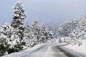
Desert View Drive is intended to remain open throughout the year, but winter storms can create snow, ice and temporary closures.
Conditions near Grand Canyon Village may differ from those near Desert View. Check the forecast and road status before committing to the drive, especially when using the East Entrance as part of a longer trip.
Do not rely on cell service for real-time navigation. Download maps before entering the park.
Summer Weather and Thunderstorms
Summer afternoons can bring lightning, heavy rain, hail and rapidly changing visibility. Exposed viewpoints are dangerous during thunderstorms.
Return to the vehicle when thunder is heard and avoid isolated trees, stone walls and open rim edges. Heavy rain may produce standing water, debris or reduced visibility on the roadway.
Accessibility
Accessibility varies among overlooks. Most developed stops provide paved parking and relatively short routes to viewing areas, but grades, uneven pavement, unpaved surfaces and historic construction may create barriers.
Desert View has designated accessible parking, restrooms and access to the Watchtower’s ground-floor View Room. The tower’s upper levels require climbing stairs.
Visitors with specific mobility needs should review current park accessibility information before choosing stops.
Pets
Leashed pets are allowed in developed areas and on designated South Rim trails above the rim. Pets are not permitted inside most public buildings, including visitor facilities, except qualifying service animals.
Do not leave animals unattended in vehicles. Interior temperatures can become dangerous even when the rim air feels comfortable.
Desert View Drive vs. Hermit Road
| Desert View Drive | Hermit Road |
|---|---|
| East of Grand Canyon Village | West of Grand Canyon Village |
| Approximately 23 miles | Approximately 7 miles |
| Open to private vehicles year-round when conditions allow | Closed to most private vehicles March through November |
| No regular shuttle along the full road | Served by the Red Route shuttle during most of the year |
| Best explored as a scenic drive | Best for shuttle-assisted sightseeing and walking |
| Includes Tusayan Pueblo and Desert View Watchtower | Includes Hopi Point, Mohave Point and Hermits Rest |
| Connects with the East Entrance | Ends west of Grand Canyon Village |
Visitors with enough time should experience both. Desert View Drive provides the stronger road-trip experience, while Hermit Road makes it easier to combine viewpoints with walking and shuttle transportation.
Read the complete Hermit Road guide »
Yes. Desert View Drive is open to private vehicles throughout the year when road and weather conditions permit.
Unlike Hermit Road, it does not have a seasonal private-vehicle prohibition.
Parking is available at each developed viewpoint, although smaller lots can fill during busy periods.
Desert View Drive is a paved state highway rather than a narrow cliff road. Drivers should still expect curves, wildlife, changing weather and heavy visitor traffic.
The developed viewpoints involve walking near the canyon rim, but visitors are not required to stand close to exposed edges.
Drive more slowly after dark and during snow, rain or limited visibility.
There is no separate admission charge for the Watchtower after entering Grand Canyon National Park.
Upper-level visits require a free onsite ticket and are available only when staffing allows.
Capacity and visit length are limited to protect the historic interior and manage the narrow staircase.
No. Lipan Point and Lipan Point Road are closed to all visitor use from June 22 through December 23, 2026, for rehabilitation.
Desert View Drive remains open, and visitors can use Navajo Point, Moran Point or Desert View Point as alternatives.
Do not park along Highway 64 near the Lipan Point Road intersection.
Yes. The East Entrance near Desert View is normally open 24 hours daily unless weather or another temporary closure affects access.
The entrance is approximately 25 miles west of Cameron on State Route 64.
It is especially practical for travelers arriving from Page, Antelope Canyon, Monument Valley or northeastern Arizona.
No regular National Park Service shuttle travels the full 23-mile Desert View Drive.
The Orange Route shuttle reaches Pipe Creek Vista near the western end, but private transportation or a commercial tour is needed for Grandview Point, Moran Point, Navajo Point and Desert View.
Visitors without a vehicle should arrange transportation before planning the scenic drive.
- Drinking water and snacks
- A full or adequate fuel supply
- Sun protection and sunglasses
- Warm and weatherproof layers
- A downloaded park map
- A headlamp for sunrise or sunset
- Traction devices during icy conditions
- Binoculars for river and wildlife viewing
Cell service is unreliable along portions of the road. Download directions and park information in advance.
Desert View Drive FAQs
How long is Desert View Drive?
Desert View Drive is approximately 23 miles from Grand Canyon Village to Desert View and the East Entrance. Driving without stops takes about one hour.
How much time should you allow?
Allow at least three hours for several major viewpoints. A half-day provides enough time for Grandview Point, Moran Point, Tusayan Pueblo, Navajo Point and Desert View Watchtower.
Can private vehicles use Desert View Drive?
Yes. Private vehicles are allowed throughout the year when the road is open. Snow, ice or emergency conditions can cause temporary closures.
Is there a shuttle along Desert View Drive?
No park shuttle travels the complete route. The Orange Route reaches Pipe Creek Vista, but a private vehicle or commercial tour is needed for the eastern viewpoints and Desert View.
Is Lipan Point open?
Lipan Point and Lipan Point Road are closed from June 22 through December 23, 2026, for rehabilitation. Desert View Drive remains open.
What are the best Desert View Drive viewpoints?
Grandview Point is best for a wide panorama, Moran Point for geology, Navajo Point for Watchtower views and Desert View Point for the Colorado River and visitor services.
Can you climb Desert View Watchtower?
Upper-floor access is available when staffing permits. A free onsite ticket is required, capacity is limited and visits are restricted to approximately 20 minutes.
Is food available at Desert View?
Yes. Desert View normally has a market, deli, coffee, ice cream and other visitor services. Hours vary by facility and season.
Is there lodging at Desert View?
No indoor lodging is available at Desert View. A seasonal campground operates by advance reservation, and hotels are available in Grand Canyon Village and nearby gateway communities.
Related Grand Canyon Guides
- Hermit Road Viewpoints and Shuttle Guide
- Grand Canyon Rim Trail Guide
- Grand Canyon Village Visitor Guide
- Grand Canyon South Rim Visitor Guide